
November 14, 2022
What’s in the forecast: Using cutting-edge weather research to advance the Waymo Driver
Weather shapes our lives, from dictating what we wear, to how we commute, to whether school is in. At Waymo, we've invested in understanding weather and its impact on our technology since our earliest days as Google's Self-Driving Car Project. We've learned a lot along the way that has enabled us to drive autonomously in various conditions, provide better service to our riders and partners, and advance our technology to serve more cities in the future.
Understanding how weather interacts with the Waymo Driver
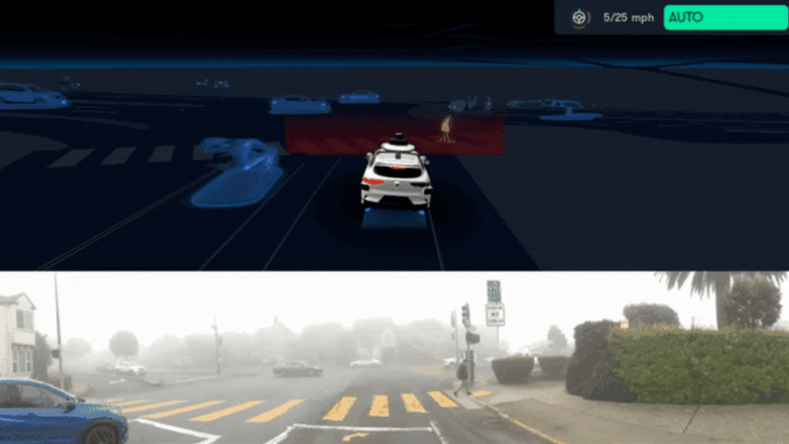
Like a human driver, the Waymo Driver needs to have a thorough understanding of its surroundings, from perceiving what other road users are doing to knowing the weather conditions it’s operating within.
Weather can be challenging for both humans and autonomous drivers. It can impact an autonomous driving system in several ways:
-
Wet roads can create reflections that cameras perceive
-
Condensation — such as fog, mist, and rain — can alter sensor data
-
Droplets, dirt, and ice can foul the surfaces of sensors similar to how these elements foul a human driver’s windshield
-
Wet and icy roads can be slippery, reducing friction
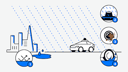
Waymo's latest hardware — complete with cameras, radar, and lidar — uses the raindrops on its windows — or lack thereof— to classify various weather conditions. Researchers have used laser-based instruments for years to measure the properties of clouds, fog, dust storms, snow, and rainfall. By employing a similar approach to the data collected by our core sensing suite and combining it with high-quality ground-truth data from weather visibility sensors, we've generated a quantitative metric about meteorological visibility.
The metric enables the Waymo Driver to conduct a quantitative analysis of the weather around the vehicle in real-time to make sense of whether it’s foggy, raining, or something else altogether and distinguish the intensity of said weather condition. Simply put, each Waymo vehicle operates as an autonomous “mobile weather station”, providing an unprecedented understanding of weather in the areas we drive.
Introducing the first-of-its-kind weather map

Today’s weather tools and datasets often lack the precision and specificity to reflect the conditions where our vehicles are driving. For example, weather stations - which are generally considered the best source for real-time weather information - are typically located at airports to support aviation safety and climate monitoring applications. But even over short distances - such as between San Francisco International Airport and the Sunset district - local conditions can vary significantly.
While remotely sensed weather data from satellites or weather radars help fill in the gaps from local weather stations, they also do not directly sense weather conditions near the surface, especially when clouds are in the way.
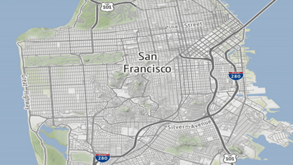
By employing our fleet of autonomously driven vehicles as mobile weather stations and combining millions of data points about the weather across time and space, we've developed – to the best of our knowledge – a first-of-its-kind fog map that provides an unparalleled amount of spatial-temporal resolution and helps us better inform our operations. With these insights, our autonomous fleet can track the progression of coastal fogs as they flow in from the Pacific Ocean and burn off as the sun rises later in the morning. It can even detect drizzle and light rains that lead to wet roads in situations that are invisible to the National Weather Service’s local Doppler weather radar. These weather observation capabilities allow us to localize where the weather conditions are beginning to deteriorate or improve. We’re using these now to enable our ride-hailing services in San Francisco and Phoenix, and we’ll create similar weather maps for additional cities as we scale.
From data collection to decision making
This detailed understanding of the current weather and its impacts on our technology also unlocks many opportunities for designing and operating our fleet of autonomously driven vehicles. For example, here are a few ways we are already utilizing our weather research to inform and improve our product and operations:

Making off-seasons, online seasons Because we use the same sensor suite to drive autonomously and collect weather data, we have an extensive dataset with which to evaluate and improve our weather simulation capabilities. Realistic weather simulations – spanning from the sensor level to the system level – enable us to improve the Waymo Driver's performance in challenging weather conditions regardless of the time of year.
Informing our operational design domains Our deep understanding of weather helps us understand how the Waymo Driver performs in rain versus snow and fog to provide the greatest benefit for our riders and partners. It also allows us to more effectively define the requirements our current and future systems need to be capable of solving, and how those requirements end up impacting the products we launch. This can lead to greater operational uptime and more efficient geographical expansion.
Providing a better service to Waymo One riders and Waymo Via delivery partners We are already utilizing our intricate understanding of the weather to help inform how we operate in a given time and location. We also plan to use this detailed view of the world to help provide our delivery partners and their customers with more accurate updates regarding their cargo, especially as we deliver freight across greater distances that span multiple geographic locations.
We are just beginning to scratch the surface of weather prediction by combining the power of our sensor suite with our weather research. If you are interested in partnering or collaborating, please reach out to us or check out our job openings at waymo.com/careers.